
Andean Patagonia region
Astonished at the size of the footprints they saw in the snow, the first explorers of Patagonia came to the conclusion that it was inhabited by giants, and so they gave these people the name Patagones, or “Big Feet”. The earliest references to the unnatural size of the Tehuelches and Onas, the original settlers, go back to 1520, when Ferdinand de Magellan sailed down the Puerto Deseado coast and his crew landed at San Julián. It is true that the men they saw where very tall and robust, but in reality they were not all that much bigger than the northern Europeans, it was just that they wrapped their feet in animal skins so that they could walk on the snow. It did not take the astonished Europeans long to realize that it was not only Patagonia’s inhabitants that where large, but also its lakes; and that its coast and steppes were never-ending, its mountain peaks unreachable. And as if all that were not enough, there were also those immense blocks of ice drifting through the water.
And the Patagones, the “Big Feet”, were not the only inhabitants. For there were also hundreds of species of strange mammals, birds and fish that made up an absolutely magnificent ecosystem. Five hundred years on, and despite the irreversible impact of human activities, Patagonia is still today a region that as been barely touched by man. Possibly one of the last refuges of nature on our planet.
The Argentinian portion of Patagonia covers an area of 786,165 km2, and extends from the Atlantic coast to the Andes, an expanse of land that is about the same size as Germany and Spain together. This is 80% of the total area of Patagonia –the remaining 20 per cent belongs to Chile. In all this vast region there are no more than one and a half million inhabitants, distributed through its five provinces: Neuquén, Río Negro, Chubut, Santa Cruz, and Tierra del Fuego. It represents one sixth of Argentina, but contains only 3,5% of its population.
Two national routes cross Patagonia.
Route 3 starts out in Buenos Aires, crosses the centre of Buenos Aires province, and then runs almost parallel with the Atlantic coast right down to Lapataia Bay in the Tierra del Fuego National Park, crossing the southern tip of the Andes in the process.
The other is Route 40, which like a real spinal chord joins the northern and southern extremities of Argentina, running parallel with the Andes. If you have enough time –a month would be ideal- and are out to make a detailed study of the region, then you could do worse than go out by Route 3 and return by Route 40 as far as San Martín de los Andes. The distances are immense, and at times the road seems desolate; the wind is strong and there are plenty of rough sections, especially on Route 40. But what you will discover as you will readily agree that no price is too great to pay for such an experience.
Just one little point to illustrate what you will see: merely between San Carlos de Bariloche and San Martín de los Andes there are at least eleven different and important tourist circuits. Between Lanín National Park in Esquel, south west Chubut, there are four national parks, more than a hundred lakes, 6,000 kilometres of rivers, hundreds of streams, mountains, and age-old forest, many of these containing specimens that disappeared long ago from other parts of the world. A staggeringly rich variety if you think that this section is but a tiny part of the vastness of Patagonia.
Here we suggest just a few of the many tours; they are the most important ones, and are based on the idea that people only have a short time available for their travels. It is supposed that in all cases the journey from Buenos Aires to the tourist centres is accomplished by plane.
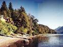
Andean Patagonia
San Martín de los Andes – Seven Lakes Route
San Carlos de Bariloche
A journey of slightly more than 200 km, through scenery that mere words cannot possibly do justice to. The seven famous lakes –Machónico, hermoso, Falkner, villarino, Correntoso, Espejo, and Nahuel Huapi- are notable for their deep, clear blue water, and the forest display an impressive range of greens.
You follow the rough Route 234 and at its junction with Route 231 it is a good idea to turn off towards Villa Angostura, a beautiful mountain village with good tourist facilities on the north side of Nahuel Huapi Lake. And absolute must here is a trip to the Quetrihué peninsula, for at its southern tip is the Bosque de Arrayanes, a unique forest containing myrtle trees over 1,000 years old. Other placeswell worth a visit in Villa Angostura are El Mesidor, the work of the famous Bustillo, which is a presidential residence that has been visited by numerous world-famous personalities who have visited the country, and Manzano Bay; a former Jesuit rest centre which owes its name to the numerous apple trees (manzanos) planted by the missionaries.
Another possibility when you get to the intersection of Routes 234 and 231 is to take the latter in the opposite direction –westwards- and go round the southern edge of Espejo Lake to El Rincón, where there is an Argentinian customs post before the road climbs to the Puyehue Pass (usable throughout the year, and one of the most accessible passes) and from there crosses into Chile. Route 234 is not surfaced, and so this tour is only advisable in spring, summer, and early autumn.
Although smaller than Bariloche, San Martín de los Andes competes with it in terms of the quality and range of its tourist facilities and the beauty of its scenery.
In spring or summertime, the main attractions are the numerous walks in the village or its surroundings, hoseriding and trips on the lake. But in winter the place turns almost exclusively into a skiing resort. The main centre is at Chapelco, 13 km from San Martín de los Andes it started life very modestly in 1946, but today Chapelco (2,390 m above sea level) can boast 26 excellently maintained slopes, a whole range of first-class facilities for skiers (including a nationally-famous ski school), and ten modern ski lifts with the capacity to transport 11,000 skiers an hour.
Excursions are organized from San Martín to the Lanín National Park, which covers a vast area extending to the Chilean frontier in the west and the Nahuel Huapi national Park in the south. There are 24 lakes in the immediate vicinity of San Martín, and countless paths that invite you to walk through the countryside. The waters of the lake basin in general drain towards the Atlantic, but Lácar is an exception to this, as its waters flow into the Pacific, and because of this it represents the main water supply for the Chocón Cerro Colorado, Piedra del Aguila and Alicurá hydroelectric schemes.
Lanín Volcano (3,774 m) is inactive, but is still dominates the landscape of the park, in which there are there nature reserves. And fishermen, as long as they take note of the times when fishing is prohibited, can catch excellent trout, salmon, and Patagonian mackerel.
Adjoining the park is the small town of Junín de los Andes, connected to san Martín by Route 234, which is paved on this section. From there, numerous trips can be taken to the volcano, and these enable visits to be made to some of the more important lakes, such as Huenchulafquen, Tromen and Paimún.
San Carlos de Bariloche – El Bolsón – Esquel
Bariloche, situated on the south east shore of Nahuel Huapi lake (extensive details can be found in the Destinations chapter of this guide), is a town that is sufficiently attractive to warrant a lengthy stay. The minimum should be four days, but if you decide to stay a couple of weeks, then you can go on a different excursion every day.
Then, after you have decided to stay for ever, it is a good idea to continue your journey in a southerly direction. Route 258 runs alongside lakes Gutiérrez and Mascardi, and at the edge of this latter is the village of the same name, where accommodation can be found, including good camping facilities. Al Pampa del Toro, a 10 km diversion along an unpaved road to lakes Steffen and Martín, in the wildest part of the park, is strongly recommended. When you rejoin the main road you will be at the end of the of the park and entering El Bolsón, the most southerly of the Río Negro district. This means you will have travelled about 130 kilometres. El Bolsón offers the most exquisite harmony between the landscape and human creatuion. Wonderful handicrafts in a spot where twentieth century technology has not yet arrived.
18 km further on along Route 258 you come to Epuyén, and from there another westerly diversion can be made to the lake Puelo National Park, where the lake itself is the major attraction. This is the smallest of the national parks, right on the border which Chile, and covers an area of 27,900 hectares. It has a very special micro-climate which enables vegetables from the Chilean Andean region to be grown, and this is the only place in Argentina where they can be found.
This park is also home to numerous native animals that are in danger of extinction elsewhere, such as the puma or America lion, and the Chilean mountain goat or guemal. Ferrets and other exotic species like the wild boar or the American bison can also be found in the park, and public access to several areas is restricted.
The administrative centre is in the small town of Lago Puelo, 3 km from the park, and which has good communications with neighbouring towns. Some 160 km further south from there along Route 258 is Esquel, the main tourist centre in the province of Chubut.
Esquel
Esquel, stands on the banks of the Esquel River; it is in a beautiful natural setting, framed by the thickly-wooded slopes of La Zeta, El 21, La Cruz and El Nahuelpán hills. Its date of foundation is taken as being that on which the telegraph was officially installed in the former 16th October settlement, out of which the town grew.
Esquel is the main gateway to Los Alerces Park , one of Patagonia’s many wonders. The park’s 24,000 hectares, which come to and end at the Chilean border, are home to numerous authentic natural treasures, and lend themselves to all sorts of different tours. In summer the lakes excursion should not be missed, this starts from Puerto Limonao, crosses the connected lakes of Futaleufquen, Verde, Menéndez and Cisne, and enters the most spectacular part of the park. Here are to be found magnificent larch trees (alerces) approximately 3,000 years old, and which reach heights of up to 70 m.
The main attraction in winter is La Hoya ski centre, 13 km from the town. it has a ski school and slopes to suit all tastes and abilities, with ski lifts that have a capacity of 4,000 people per hour.
A number of interesting day trips can be made from Esquel. One of these is along Route 259 to the pretty town of Trevelín, which in Welsh means “village of the mill”, in memory of the first flour mill to be built in the area.
There then follows, an attractive journey along Route 259 past the Nant Waterfalls and the fish farm to the Futaleufú international pass, which leads to the Chilean village of the same name; its traditional wooden buildings are typical of southern Chile. If you like, you can continue to Chaitén, capital of the Chilean province of Palena, which is 225 km from Esquel on the Pacific Ocean.
Another interesting day trip is to the village of Lago Rosario, which lies on the lake of the same name, and which is renowned for its locally-woven fabrics. From there you continue to Vintter Lake; another good fishing spot where the scenery is wonderful.
For those with a sense of nostalgia there is one trip which is like a journey through time. You have to be ready to sit on wooden seats for a long period, for this is the narrow-gauge (75 cm) rail trip from Esquel to Ingeniero Jacobacci. “La Trochita”, as the locals lovingly call it, is and old train hauled to be declared part of the country’s historical heritage; while it waits to know its fate, it continues to haul passengers twice a week.
The Atlantic Coast
Puerto Madryn – Valdés Península – Rawson
Gaimán – Punta Tombo – Camarones
There are good connections by air between Buenos Aires and both Rawson and Trelew. This tour can start from either of these two towns, preferably by car. Public transport is available, but the possibilities are much more limited.
Puerto Madryn is situated at the mouth of the Chubut River; a few kilometres north of the original Welsh settlement. It is a small but pleasant town with generally good accommodation and services. Its first inhabitants were Welsh settlers who landed on the shores of the New Gulf, fleeing from political persecution in Great Britain.
The coast off Puerto Madryn, in the peaceful waters of new Gulf, is a haven for skin-divers in summer. The water is crystal clear, and the tremendous variety of underwater like can easily be observed on this 400 km wide platform -one of the widest in the world- that runs right down the Atlantic coast.
But Madryn’s major tourist attraction is the Valdés Peninsula, an incredible refuge for sea mammals just 20 km away. It is reached via Route 3 from its junction with provincial Route 2, a road that on the peninsula is unpaved.
Its most famous guest, the enormous, tame, right whales, start to arrive from the south in July. They go there to mate and breed their young. It is wonderful to see these two-ton “babies” frolicking with their mothers as they clumsily learn their lessons. They can be observed by taking a boat trip from Puerto Pirámide. The whales stay until December, with the babies being born between August and October. This is the only place in the world where they can be seen so close to the coast.
Other equally illustrious visitors arrive in early January, the sea lions. Always full of life and always in schools, they can be observed in hard-fought battles to win over the females –nobody has taught them the idea of monogamy- or to mark out the individual territory of each male, all the time performing wonderful pirouettes in the water or showing off their swimming skills.
You should not leave the Valdés Peninsula without looking at the bird life. Bird Island has some exclusive residents; the public are not allowed access, but the birds can still be seen if you have suitable optical equipment. There is an `Interpretation Centre´, and all excursions on the peninsula are accompanied by a wildlife guide. It is best to book these excursions in advance, since the number of tourists allowed onto the peninsula is strictly controlled, in an attempt not to harm its delicate ecosystem.
You will see more sea lions and sea elephants at Punta Loma, 15 km south of Puerto Madryn. And continuing along Route 3, you come to the towns of Rawson and Trelew; lying on opposite banks of the Trelew River; Rawson is the administrative centre for the whole province, and its neighbour Trelew the busiest town in the area, with buildings dating back to the time of the original Welsh settlement and an interesting paleontological Museum.
The Tombo penguin colony is reached via Route 1 (in poor condition) and then a further 24 km along a dirt road. About one million penguins congregate here between September and March; they can be observed from a prudent distance, as they are somewhat timid, but they are very likable.
You continue along Route 1 as far as Camarones, a small fishing village with a fine and almost deserted beach, where even in summer you will almost certainly not be able to go swimming. The water is very cold, but if you are a fishing enthusiast, then you will be able to enjoy yourself. During summer a colony of sea lions can be seen off the beach.
Comodoro Rivadavia – Puerto Deseado
Puerto San Julián
The San Jorge Gulf is like a huge mouth opening onto the Atlantic between the provinces of Chubut and Santa Cruz. There, on the sea but surrounded by arid and monotonous scenery, lies Comodoro Rivadavia Lonely, in the middle of the gulf, and with no major tourist attractions, this is the most important oil city in the country.
If you have come down from the valdés Peninsula, Punta Tombo or Camarones, you will have travelled along Route 3, one of the best sections of which comes after Comodoro Rivadavia, where it runs alongside the gulf. The road turns away from the coast at the small oil town of Caleta Olivia, and continues to Puerto Deseado, another small town lying on the estuary of the same name. Excellent fishing is available there, even for sharks. You will also see beautiful sea birds, including the very strange grey cormorant. The whole area is one of deserted beaches and excellent fishing; most of the coast belongs to great estates and has difficult dirt tracks.
By way of contrast, the section of Route 3 that links Puerto San Julián, Luis Piedrabuena and Puerto Santa Cruz is monotonous and desolate. These three towns are on some of the very few natural harbours in Argentinian Patagonia, lying on estuaries where there is good fishing. The variety of seafood is excellent, (it includes prawns and octopus), as is the range of fish –hake, cod, bream, sole, mackerel and dogfish. You do not need to be a fisherman, for on these beaches where it seems that no human foot has ever trodden before yours, you can pick up the seafood with you’re bare hands and later enjoy cooking it as your fancy takes you. There are no restrictions on fishing along Patagonia’s Atlantic coast. But it is always a good idea to ask in the different villages what the best time to go is, and to fish in the company of experienced fishermen. To reach the two `petrified forest´ in Chubut, you take Route 26 from Comodoro Rivadavia, which is paved for the first 60 km, as far as Colonia Sarmiento. From this tiny village you continue southwards along a dirt road. Nearby are two interesting lakes with good fishing: Musters and Colhué Huapi.
If you rejoin Route 3 and head towards the province of Santa Cruz, you turn off in Puerto Deseado and continue for some 45 km until you come to the Santa Cruz Petrified Forest Nature Reserve.
Río Gallegos – Río Grande – Ushuaia
El Calafate – The Glaciers

Río Gallegos
This is the most southerly mainland town in Argentina, and capital of Santa Cruz province, which is second in size only to Buenos Aires province. Located on the banks of the Gallegos River, it is a good deep-water port, and because of this fact, through it passes much of Patagonia’s important wool production. Basically, a is an industrial town and highly important in the economy of the region, but it has little to attract tourist.
Its international airport has connections with other parts of Patagonia and with Chile, which means it is the starting point for the most interesting tours, especially those to the province’s two national parks: The Glaciers, and Perito Moreno, in the Andes, where some of the most important lakes in Patagonia are also to be found, such as Buenos Aires, Viedma and Argentino.
There are a number of interesting places to visit near Río Gallegos: the impressive Laguna Azul (Blue Lagoon) in the crater of an extinct volcano, which gives you the strange sensation of being in the middle of a lunar landscape; the Penguin Island provincial reserve, and the capes of Buen Tiempo and Vírgenes; where there is a beautiful lighthouse you can see the island of Tierra del Fuego –shared by Argentina and Chile- and you will have come to the tip of the Argentinian mainland. In other words, you will be that little bit nearer to the “end of the World”.
Route 3 continues on the island, still in Argentina, until it comes to and end at Lapataia Bay in the Tierra del Fuego National Park, after passing through Río Grande and Ushuaia. This section is unpaved.
The first town you come to when crossing the island is Río Grande, on the banks of the river of the same name where it flows into the Atlantic, and still in a landscape of steppe with no natural barriers to protect it from the wind. It is the economic capital of the island, rich in oil and gas, and with a lively industrial estate. Despite its industrial features, Río Grande is a welcoming town with good links with Buenos Aires. It is 230 km from Ushuaia.
Ushuaia
Ushuaia is the capital of Argentina’s newest province, Tierra del Fuego; or to give it its official name, Tierra del Fuego, Antártida e Isles del Atlántico Sur, a title it has held since 26 April 1990.
It is the only town in Argentina situated on the other side of the Andean range, and along with the small Chilean village of Puerto Williams, is the most southerly in the world. Because of its geographical position, with the Andes to the north, the Beagle Channel to the south, and the Tierra del Fuego National Park to the west. Ushuaia can only grow in an easterly direction. For the same reason, it looks more like something out of a picture than a real town.
The earliest inhabitant, the Yaganes or Onas, had named the bay well: Ushuaia meant “bay which penetrates to the west”.
The first Europeans to visit these coast were Ferdinand de Magellan and his crew, on their famous first circumnavigation of the globe in 1520. For more than ten thousand years before that date, the area had been inhabited by the Yaganes.
The last decade has seen a sort of “new discovery” of Tierra del Fuego, but this time by tourist. Slowly but surely, Ushuaia and Río Grande are leaving behind their image as the Cinderellas of the Country, and are finding a destiny more in line with their tourist potential. Some forty thousand tourists arrive every year, avidly seeking contact with a vegetation that still retains its natural features, to go skiing (the best slopes in the country are to be found there), to sail Tierra del Fuego’s channels, or go on excursions to Cape Horn of Antarctica. In Ushuaia itself, san Martín Street is a busy commercial centre where imported products can be bought.
But Ushuaia much more than just a good shopping centre. You only need to turn your head away from the commercial centre to come face to face with the exciting water of the Beagle Channel, to rejoice in the sight of the ships that have dropped anchor in the port, and remember that your are no more than 500 km away from Antarctica.
Most of the town itself can be visited on foot. You should not miss the Museo del Fin del Mundo (the end of the World Museum), which contains an interesting selection of items relating to the past history of the island, a bird room, and a complete library of books on Patagonian subjects. Another “must” is the End of the World Lighthouse.
Excursions to the park can be by land or sea, or ideally by a combination of the two, since it is best not to miss anything. There is a lot to see: native forests, Laguna Negra (Black Lagoon), the Pipo River; Las Agujas Forest, the Lapataia River –its bay provides one of the best views of the park, and marks the end of Route 3. ask Ushuaia travel agencies about guided walks and horse riding tours of the park.
Ships start from the port for the journey through the channel to Lapataia Bay. And there are other excursions to neighbouring towns in Chile: Puerto Williams, virtually opposite Ushuaia, Porvenir or punta Arenas. You sail through a landscape of fjords that is typical of the Chilean coast. In an easterly direction trips go to the End of the World Lighthouse; to Bird Island, to Martillo Island (for the penguin colony), and to Harberton Bay, which belongs to the Harberton estate; the Harbertons were descendents of Ushuaia pioneer, Thomas Bridges. Another interesting excursion is to Staten Island, also in an easterly direction.
But the real attractions are the Antarctic crises. These can be undertaken in different types of ships, ranging from the extremely luxurious to much more economical options. Either before you leave, or else on board ship, experts give talks on the scientific value of this type of expedition. All these trips take place in spring –from the beginning of October and summer.
You take the same road that brought you the island -Route 3- in order to go back to the mainland. Whichever way you are going, between Río Grande and Ushuaia you should stop to make a trip to Fagnano and Escondido Lakes. The first of these is one of the biggest lakes in Patagonia, and is shared with Chile; on its Argentinian side it covers an area of about 500 km2. By the lake is an inn that should not be missed. A small diversion will take you to the charming village of Tolhuin (it has less than a thousand inhabitants), hidden in the middle of a forest.
Another diversion will take you to Escondido (Hidden) Lake. And it is along Route 3 that Ushuaia’s five ski centres are to be found, including the famous Valley of the Huskies, the only place in all South America where Husky dogs are bred –the ones that pull sledges.
Once you have crossed back from the northern tip of the island, you continue on the mainland along Route 3 to its junction with Route 40 near Río Gallegos and head for el Calafate. This is a 312 km journey, mostly paved. You should stop at the tiny settlement of La Esperanza to stock up on supplies, for after this there is nothing but Patagonian steppe.
Another way of getting from Tierra del Fuego to El Calafate is through Chile, crossing at the island’s only frontier post of San Sebastián, from there you go by boat through the Straits of Magallan (belonging to Chile) and on to Puerto Natales, an attractive town on the Pacific, from where you can continue over El Turbio pass, which is open all year round, to the town of Río Turbio, in Santa Cruz. Back on Argentinian soil once more, the journey continues along the unpaved Route 40 to El Calafate. This route is, of course, much longer, and the various customs inspections can be irritating, but its value lies in that this way you will see something of the Chilean part of Patagonia.
The small village of El Calafate, which as no more than three thousand inhabitants, has good tourist facilities, and is the gateway to The Glaciers National Park. Lying on one shore of Argentino Lake, its hotels and restaurants are adequate, and it also has cheaper accommodation available in family homes adapted as pensions and the like. It even has a couple of discotheques.
El Calafate also has a modest airfield, and light aircraft link it with the provincial capital. Once you are fully relaxed, you have to get ready for one of the most exciting experiences that nature can offer. 60 km from the village the Andes mountains await you, with their colossal icefields. A road runs along the shore of Argentino Lake, which covers an area of 1,415 km2. this divides at Buenos Aires hill, with one road leading to the National Park and the other to Puerto Bandera, where lake excursions start to the Upsula, Onelli, Agassiz and Bolados glaciers.
UNESCO has declared The Glaciers National Park part of the Cultural Heritage of Mankind. It covers an area of six hundred thousand hectares in the Andean zone, and 47 glaciers come down into this Ice Field, the most famous of them being the Perito Moreno. This extends over the southern arm of the lake at an average height of 60 m, and pieces of ice are constantly breaking off its front wall and falling into the empty loneliness that is all around. This glacier also “moves”; every two or three years it advances towards terra firma, a phenomenon which draws thousands of tourists from far and wide. The pressure of the water causes the glacier to split, and enormous blocks of ice begin to drift like ghost ships along the Tempanos Channel; on the days immediately before this magnificent natural spectacle, the waters of the Brazo Rico begin to rise. It is advisable to always travel in this area in the company either of guides or people who know the region well; never try to go off on your own.
If you decide to go on the lake excursion, you will have to get up early: departure time is 7.30, and as they say, “there are no more”. Return is around 6.00 in the evening. But what you will experience during this short period of just under twelve hours is worth any sacrifice. You travel along the northern arm of lake to the Upsala glacier; the biggest of all. There you will see what looks like a giant tongue of ice, 50 km long and 10 km wide, although these measurements are only approximate. It just has to be seen, that’s all! The excursion continues to Onelli Bay; and then by land to the lake of the same name, where there are yet more glaciers: Agassiz, Bolados and Onelli. The return leaves you deeply moved, leads you to reflect on the origins of the universe, of simply leaves you speechless. But nobody can remain indifferent.
The northern tip of the park extends to Viedma Lake, 1,088 km2 in area, where the Viedma and Moyano glaciers can be seen descending into its waters; the road is unpaved and twists around the lake as far as Chaltén, on the western shore, where there is a store offering basic provisions. In the background can be seen two mountains: Torre (3,128 m) and Fitz Roy (3,375 m). Both these peaks have been the goal of numerous mountaineers. Inhospitable, yet with an impressive beauty, this area is ideal for a number of adventure tours that start from El Calafate (see Adventure Tourism chapter).
Viedma lake is 240 km from El Calafate, and in summer a minibus company operates a service between the two places. This is along Route 40, and if you follow this north wards and then turn off onto a dirt road, you come to the Perito Moreno National Park, at the foot of Mount Lorenzo (3,700 m). this park covers an area of 115 thousand hectares and is a wonderful nature reserve set in wild, beautiful scenery. There are no facilities in the park, but a number of campsites and very basic hotels can be found along Route 40. in the surrounding area, well known spots like Bajo Caracoles and the Cueva de las Manos should be visited in the Pinturas River Canyon.
Astonished at the size of the footprints they saw in the snow, the first explorers of Patagonia came to the conclusion that it was inhabited by giants, and so they gave these people the name Patagones, or “Big Feet”. The earliest references to the unnatural size of the Tehuelches and Onas, the original settlers, go back to 1520, when Ferdinand de Magellan sailed down the Puerto Deseado coast and his crew landed at San Julián. It is true that the men they saw where very tall and robust, but in reality they were not all that much bigger than the northern Europeans, it was just that they wrapped their feet in animal skins so that they could walk on the snow. It did not take the astonished Europeans long to realize that it was not only Patagonia’s inhabitants that where large, but also its lakes; and that its coast and steppes were never-ending, its mountain peaks unreachable. And as if all that were not enough, there were also those immense blocks of ice drifting through the water.
And the Patagones, the “Big Feet”, were not the only inhabitants. For there were also hundreds of species of strange mammals, birds and fish that made up an absolutely magnificent ecosystem. Five hundred years on, and despite the irreversible impact of human activities, Patagonia is still today a region that as been barely touched by man. Possibly one of the last refuges of nature on our planet.
The Argentinian portion of Patagonia covers an area of 786,165 km2, and extends from the Atlantic coast to the Andes, an expanse of land that is about the same size as Germany and Spain together. This is 80% of the total area of Patagonia –the remaining 20 per cent belongs to Chile. In all this vast region there are no more than one and a half million inhabitants, distributed through its five provinces: Neuquén, Río Negro, Chubut, Santa Cruz, and Tierra del Fuego. It represents one sixth of Argentina, but contains only 3,5% of its population.
Two national routes cross Patagonia.
Route 3 starts out in Buenos Aires, crosses the centre of Buenos Aires province, and then runs almost parallel with the Atlantic coast right down to Lapataia Bay in the Tierra del Fuego National Park, crossing the southern tip of the Andes in the process.
The other is Route 40, which like a real spinal chord joins the northern and southern extremities of Argentina, running parallel with the Andes. If you have enough time –a month would be ideal- and are out to make a detailed study of the region, then you could do worse than go out by Route 3 and return by Route 40 as far as San Martín de los Andes. The distances are immense, and at times the road seems desolate; the wind is strong and there are plenty of rough sections, especially on Route 40. But what you will discover as you will readily agree that no price is too great to pay for such an experience.
Just one little point to illustrate what you will see: merely between San Carlos de Bariloche and San Martín de los Andes there are at least eleven different and important tourist circuits. Between Lanín National Park in Esquel, south west Chubut, there are four national parks, more than a hundred lakes, 6,000 kilometres of rivers, hundreds of streams, mountains, and age-old forest, many of these containing specimens that disappeared long ago from other parts of the world. A staggeringly rich variety if you think that this section is but a tiny part of the vastness of Patagonia.
Here we suggest just a few of the many tours; they are the most important ones, and are based on the idea that people only have a short time available for their travels. It is supposed that in all cases the journey from Buenos Aires to the tourist centres is accomplished by plane.

Andean Patagonia
San Martín de los Andes – Seven Lakes Route
San Carlos de Bariloche
A journey of slightly more than 200 km, through scenery that mere words cannot possibly do justice to. The seven famous lakes –Machónico, hermoso, Falkner, villarino, Correntoso, Espejo, and Nahuel Huapi- are notable for their deep, clear blue water, and the forest display an impressive range of greens.
You follow the rough Route 234 and at its junction with Route 231 it is a good idea to turn off towards Villa Angostura, a beautiful mountain village with good tourist facilities on the north side of Nahuel Huapi Lake. And absolute must here is a trip to the Quetrihué peninsula, for at its southern tip is the Bosque de Arrayanes, a unique forest containing myrtle trees over 1,000 years old. Other placeswell worth a visit in Villa Angostura are El Mesidor, the work of the famous Bustillo, which is a presidential residence that has been visited by numerous world-famous personalities who have visited the country, and Manzano Bay; a former Jesuit rest centre which owes its name to the numerous apple trees (manzanos) planted by the missionaries.
Another possibility when you get to the intersection of Routes 234 and 231 is to take the latter in the opposite direction –westwards- and go round the southern edge of Espejo Lake to El Rincón, where there is an Argentinian customs post before the road climbs to the Puyehue Pass (usable throughout the year, and one of the most accessible passes) and from there crosses into Chile. Route 234 is not surfaced, and so this tour is only advisable in spring, summer, and early autumn.
Although smaller than Bariloche, San Martín de los Andes competes with it in terms of the quality and range of its tourist facilities and the beauty of its scenery.
In spring or summertime, the main attractions are the numerous walks in the village or its surroundings, hoseriding and trips on the lake. But in winter the place turns almost exclusively into a skiing resort. The main centre is at Chapelco, 13 km from San Martín de los Andes it started life very modestly in 1946, but today Chapelco (2,390 m above sea level) can boast 26 excellently maintained slopes, a whole range of first-class facilities for skiers (including a nationally-famous ski school), and ten modern ski lifts with the capacity to transport 11,000 skiers an hour.
Excursions are organized from San Martín to the Lanín National Park, which covers a vast area extending to the Chilean frontier in the west and the Nahuel Huapi national Park in the south. There are 24 lakes in the immediate vicinity of San Martín, and countless paths that invite you to walk through the countryside. The waters of the lake basin in general drain towards the Atlantic, but Lácar is an exception to this, as its waters flow into the Pacific, and because of this it represents the main water supply for the Chocón Cerro Colorado, Piedra del Aguila and Alicurá hydroelectric schemes.
Lanín Volcano (3,774 m) is inactive, but is still dominates the landscape of the park, in which there are there nature reserves. And fishermen, as long as they take note of the times when fishing is prohibited, can catch excellent trout, salmon, and Patagonian mackerel.
Adjoining the park is the small town of Junín de los Andes, connected to san Martín by Route 234, which is paved on this section. From there, numerous trips can be taken to the volcano, and these enable visits to be made to some of the more important lakes, such as Huenchulafquen, Tromen and Paimún.
San Carlos de Bariloche – El Bolsón – Esquel
Bariloche, situated on the south east shore of Nahuel Huapi lake (extensive details can be found in the Destinations chapter of this guide), is a town that is sufficiently attractive to warrant a lengthy stay. The minimum should be four days, but if you decide to stay a couple of weeks, then you can go on a different excursion every day.
Then, after you have decided to stay for ever, it is a good idea to continue your journey in a southerly direction. Route 258 runs alongside lakes Gutiérrez and Mascardi, and at the edge of this latter is the village of the same name, where accommodation can be found, including good camping facilities. Al Pampa del Toro, a 10 km diversion along an unpaved road to lakes Steffen and Martín, in the wildest part of the park, is strongly recommended. When you rejoin the main road you will be at the end of the of the park and entering El Bolsón, the most southerly of the Río Negro district. This means you will have travelled about 130 kilometres. El Bolsón offers the most exquisite harmony between the landscape and human creatuion. Wonderful handicrafts in a spot where twentieth century technology has not yet arrived.
18 km further on along Route 258 you come to Epuyén, and from there another westerly diversion can be made to the lake Puelo National Park, where the lake itself is the major attraction. This is the smallest of the national parks, right on the border which Chile, and covers an area of 27,900 hectares. It has a very special micro-climate which enables vegetables from the Chilean Andean region to be grown, and this is the only place in Argentina where they can be found.
This park is also home to numerous native animals that are in danger of extinction elsewhere, such as the puma or America lion, and the Chilean mountain goat or guemal. Ferrets and other exotic species like the wild boar or the American bison can also be found in the park, and public access to several areas is restricted.
The administrative centre is in the small town of Lago Puelo, 3 km from the park, and which has good communications with neighbouring towns. Some 160 km further south from there along Route 258 is Esquel, the main tourist centre in the province of Chubut.
Esquel
Esquel, stands on the banks of the Esquel River; it is in a beautiful natural setting, framed by the thickly-wooded slopes of La Zeta, El 21, La Cruz and El Nahuelpán hills. Its date of foundation is taken as being that on which the telegraph was officially installed in the former 16th October settlement, out of which the town grew.
Esquel is the main gateway to Los Alerces Park , one of Patagonia’s many wonders. The park’s 24,000 hectares, which come to and end at the Chilean border, are home to numerous authentic natural treasures, and lend themselves to all sorts of different tours. In summer the lakes excursion should not be missed, this starts from Puerto Limonao, crosses the connected lakes of Futaleufquen, Verde, Menéndez and Cisne, and enters the most spectacular part of the park. Here are to be found magnificent larch trees (alerces) approximately 3,000 years old, and which reach heights of up to 70 m.
The main attraction in winter is La Hoya ski centre, 13 km from the town. it has a ski school and slopes to suit all tastes and abilities, with ski lifts that have a capacity of 4,000 people per hour.
A number of interesting day trips can be made from Esquel. One of these is along Route 259 to the pretty town of Trevelín, which in Welsh means “village of the mill”, in memory of the first flour mill to be built in the area.
There then follows, an attractive journey along Route 259 past the Nant Waterfalls and the fish farm to the Futaleufú international pass, which leads to the Chilean village of the same name; its traditional wooden buildings are typical of southern Chile. If you like, you can continue to Chaitén, capital of the Chilean province of Palena, which is 225 km from Esquel on the Pacific Ocean.
Another interesting day trip is to the village of Lago Rosario, which lies on the lake of the same name, and which is renowned for its locally-woven fabrics. From there you continue to Vintter Lake; another good fishing spot where the scenery is wonderful.
For those with a sense of nostalgia there is one trip which is like a journey through time. You have to be ready to sit on wooden seats for a long period, for this is the narrow-gauge (75 cm) rail trip from Esquel to Ingeniero Jacobacci. “La Trochita”, as the locals lovingly call it, is and old train hauled to be declared part of the country’s historical heritage; while it waits to know its fate, it continues to haul passengers twice a week.
The Atlantic Coast

Puerto Madryn – Valdés Península – Rawson
Gaimán – Punta Tombo – Camarones
There are good connections by air between Buenos Aires and both Rawson and Trelew. This tour can start from either of these two towns, preferably by car. Public transport is available, but the possibilities are much more limited.
Puerto Madryn is situated at the mouth of the Chubut River; a few kilometres north of the original Welsh settlement. It is a small but pleasant town with generally good accommodation and services. Its first inhabitants were Welsh settlers who landed on the shores of the New Gulf, fleeing from political persecution in Great Britain.
The coast off Puerto Madryn, in the peaceful waters of new Gulf, is a haven for skin-divers in summer. The water is crystal clear, and the tremendous variety of underwater like can easily be observed on this 400 km wide platform -one of the widest in the world- that runs right down the Atlantic coast.
But Madryn’s major tourist attraction is the Valdés Peninsula, an incredible refuge for sea mammals just 20 km away. It is reached via Route 3 from its junction with provincial Route 2, a road that on the peninsula is unpaved.
Its most famous guest, the enormous, tame, right whales, start to arrive from the south in July. They go there to mate and breed their young. It is wonderful to see these two-ton “babies” frolicking with their mothers as they clumsily learn their lessons. They can be observed by taking a boat trip from Puerto Pirámide. The whales stay until December, with the babies being born between August and October. This is the only place in the world where they can be seen so close to the coast.
Other equally illustrious visitors arrive in early January, the sea lions. Always full of life and always in schools, they can be observed in hard-fought battles to win over the females –nobody has taught them the idea of monogamy- or to mark out the individual territory of each male, all the time performing wonderful pirouettes in the water or showing off their swimming skills.
You should not leave the Valdés Peninsula without looking at the bird life. Bird Island has some exclusive residents; the public are not allowed access, but the birds can still be seen if you have suitable optical equipment. There is an `Interpretation Centre´, and all excursions on the peninsula are accompanied by a wildlife guide. It is best to book these excursions in advance, since the number of tourists allowed onto the peninsula is strictly controlled, in an attempt not to harm its delicate ecosystem.
You will see more sea lions and sea elephants at Punta Loma, 15 km south of Puerto Madryn. And continuing along Route 3, you come to the towns of Rawson and Trelew; lying on opposite banks of the Trelew River; Rawson is the administrative centre for the whole province, and its neighbour Trelew the busiest town in the area, with buildings dating back to the time of the original Welsh settlement and an interesting paleontological Museum.
The Tombo penguin colony is reached via Route 1 (in poor condition) and then a further 24 km along a dirt road. About one million penguins congregate here between September and March; they can be observed from a prudent distance, as they are somewhat timid, but they are very likable.
You continue along Route 1 as far as Camarones, a small fishing village with a fine and almost deserted beach, where even in summer you will almost certainly not be able to go swimming. The water is very cold, but if you are a fishing enthusiast, then you will be able to enjoy yourself. During summer a colony of sea lions can be seen off the beach.
Comodoro Rivadavia – Puerto Deseado
Puerto San Julián
The San Jorge Gulf is like a huge mouth opening onto the Atlantic between the provinces of Chubut and Santa Cruz. There, on the sea but surrounded by arid and monotonous scenery, lies Comodoro Rivadavia Lonely, in the middle of the gulf, and with no major tourist attractions, this is the most important oil city in the country.
If you have come down from the valdés Peninsula, Punta Tombo or Camarones, you will have travelled along Route 3, one of the best sections of which comes after Comodoro Rivadavia, where it runs alongside the gulf. The road turns away from the coast at the small oil town of Caleta Olivia, and continues to Puerto Deseado, another small town lying on the estuary of the same name. Excellent fishing is available there, even for sharks. You will also see beautiful sea birds, including the very strange grey cormorant. The whole area is one of deserted beaches and excellent fishing; most of the coast belongs to great estates and has difficult dirt tracks.
By way of contrast, the section of Route 3 that links Puerto San Julián, Luis Piedrabuena and Puerto Santa Cruz is monotonous and desolate. These three towns are on some of the very few natural harbours in Argentinian Patagonia, lying on estuaries where there is good fishing. The variety of seafood is excellent, (it includes prawns and octopus), as is the range of fish –hake, cod, bream, sole, mackerel and dogfish. You do not need to be a fisherman, for on these beaches where it seems that no human foot has ever trodden before yours, you can pick up the seafood with you’re bare hands and later enjoy cooking it as your fancy takes you. There are no restrictions on fishing along Patagonia’s Atlantic coast. But it is always a good idea to ask in the different villages what the best time to go is, and to fish in the company of experienced fishermen. To reach the two `petrified forest´ in Chubut, you take Route 26 from Comodoro Rivadavia, which is paved for the first 60 km, as far as Colonia Sarmiento. From this tiny village you continue southwards along a dirt road. Nearby are two interesting lakes with good fishing: Musters and Colhué Huapi.
If you rejoin Route 3 and head towards the province of Santa Cruz, you turn off in Puerto Deseado and continue for some 45 km until you come to the Santa Cruz Petrified Forest Nature Reserve.
Río Gallegos – Río Grande – Ushuaia
El Calafate – The Glaciers

Río Gallegos
This is the most southerly mainland town in Argentina, and capital of Santa Cruz province, which is second in size only to Buenos Aires province. Located on the banks of the Gallegos River, it is a good deep-water port, and because of this fact, through it passes much of Patagonia’s important wool production. Basically, a is an industrial town and highly important in the economy of the region, but it has little to attract tourist.
Its international airport has connections with other parts of Patagonia and with Chile, which means it is the starting point for the most interesting tours, especially those to the province’s two national parks: The Glaciers, and Perito Moreno, in the Andes, where some of the most important lakes in Patagonia are also to be found, such as Buenos Aires, Viedma and Argentino.
There are a number of interesting places to visit near Río Gallegos: the impressive Laguna Azul (Blue Lagoon) in the crater of an extinct volcano, which gives you the strange sensation of being in the middle of a lunar landscape; the Penguin Island provincial reserve, and the capes of Buen Tiempo and Vírgenes; where there is a beautiful lighthouse you can see the island of Tierra del Fuego –shared by Argentina and Chile- and you will have come to the tip of the Argentinian mainland. In other words, you will be that little bit nearer to the “end of the World”.
Route 3 continues on the island, still in Argentina, until it comes to and end at Lapataia Bay in the Tierra del Fuego National Park, after passing through Río Grande and Ushuaia. This section is unpaved.
The first town you come to when crossing the island is Río Grande, on the banks of the river of the same name where it flows into the Atlantic, and still in a landscape of steppe with no natural barriers to protect it from the wind. It is the economic capital of the island, rich in oil and gas, and with a lively industrial estate. Despite its industrial features, Río Grande is a welcoming town with good links with Buenos Aires. It is 230 km from Ushuaia.
Ushuaia
Ushuaia is the capital of Argentina’s newest province, Tierra del Fuego; or to give it its official name, Tierra del Fuego, Antártida e Isles del Atlántico Sur, a title it has held since 26 April 1990.
It is the only town in Argentina situated on the other side of the Andean range, and along with the small Chilean village of Puerto Williams, is the most southerly in the world. Because of its geographical position, with the Andes to the north, the Beagle Channel to the south, and the Tierra del Fuego National Park to the west. Ushuaia can only grow in an easterly direction. For the same reason, it looks more like something out of a picture than a real town.
The earliest inhabitant, the Yaganes or Onas, had named the bay well: Ushuaia meant “bay which penetrates to the west”.
The first Europeans to visit these coast were Ferdinand de Magellan and his crew, on their famous first circumnavigation of the globe in 1520. For more than ten thousand years before that date, the area had been inhabited by the Yaganes.
The last decade has seen a sort of “new discovery” of Tierra del Fuego, but this time by tourist. Slowly but surely, Ushuaia and Río Grande are leaving behind their image as the Cinderellas of the Country, and are finding a destiny more in line with their tourist potential. Some forty thousand tourists arrive every year, avidly seeking contact with a vegetation that still retains its natural features, to go skiing (the best slopes in the country are to be found there), to sail Tierra del Fuego’s channels, or go on excursions to Cape Horn of Antarctica. In Ushuaia itself, san Martín Street is a busy commercial centre where imported products can be bought.
But Ushuaia much more than just a good shopping centre. You only need to turn your head away from the commercial centre to come face to face with the exciting water of the Beagle Channel, to rejoice in the sight of the ships that have dropped anchor in the port, and remember that your are no more than 500 km away from Antarctica.
Most of the town itself can be visited on foot. You should not miss the Museo del Fin del Mundo (the end of the World Museum), which contains an interesting selection of items relating to the past history of the island, a bird room, and a complete library of books on Patagonian subjects. Another “must” is the End of the World Lighthouse.
Excursions to the park can be by land or sea, or ideally by a combination of the two, since it is best not to miss anything. There is a lot to see: native forests, Laguna Negra (Black Lagoon), the Pipo River; Las Agujas Forest, the Lapataia River –its bay provides one of the best views of the park, and marks the end of Route 3. ask Ushuaia travel agencies about guided walks and horse riding tours of the park.
Ships start from the port for the journey through the channel to Lapataia Bay. And there are other excursions to neighbouring towns in Chile: Puerto Williams, virtually opposite Ushuaia, Porvenir or punta Arenas. You sail through a landscape of fjords that is typical of the Chilean coast. In an easterly direction trips go to the End of the World Lighthouse; to Bird Island, to Martillo Island (for the penguin colony), and to Harberton Bay, which belongs to the Harberton estate; the Harbertons were descendents of Ushuaia pioneer, Thomas Bridges. Another interesting excursion is to Staten Island, also in an easterly direction.
But the real attractions are the Antarctic crises. These can be undertaken in different types of ships, ranging from the extremely luxurious to much more economical options. Either before you leave, or else on board ship, experts give talks on the scientific value of this type of expedition. All these trips take place in spring –from the beginning of October and summer.
You take the same road that brought you the island -Route 3- in order to go back to the mainland. Whichever way you are going, between Río Grande and Ushuaia you should stop to make a trip to Fagnano and Escondido Lakes. The first of these is one of the biggest lakes in Patagonia, and is shared with Chile; on its Argentinian side it covers an area of about 500 km2. By the lake is an inn that should not be missed. A small diversion will take you to the charming village of Tolhuin (it has less than a thousand inhabitants), hidden in the middle of a forest.
Another diversion will take you to Escondido (Hidden) Lake. And it is along Route 3 that Ushuaia’s five ski centres are to be found, including the famous Valley of the Huskies, the only place in all South America where Husky dogs are bred –the ones that pull sledges.
Once you have crossed back from the northern tip of the island, you continue on the mainland along Route 3 to its junction with Route 40 near Río Gallegos and head for el Calafate. This is a 312 km journey, mostly paved. You should stop at the tiny settlement of La Esperanza to stock up on supplies, for after this there is nothing but Patagonian steppe.
Another way of getting from Tierra del Fuego to El Calafate is through Chile, crossing at the island’s only frontier post of San Sebastián, from there you go by boat through the Straits of Magallan (belonging to Chile) and on to Puerto Natales, an attractive town on the Pacific, from where you can continue over El Turbio pass, which is open all year round, to the town of Río Turbio, in Santa Cruz. Back on Argentinian soil once more, the journey continues along the unpaved Route 40 to El Calafate. This route is, of course, much longer, and the various customs inspections can be irritating, but its value lies in that this way you will see something of the Chilean part of Patagonia.
The small village of El Calafate, which as no more than three thousand inhabitants, has good tourist facilities, and is the gateway to The Glaciers National Park. Lying on one shore of Argentino Lake, its hotels and restaurants are adequate, and it also has cheaper accommodation available in family homes adapted as pensions and the like. It even has a couple of discotheques.
El Calafate also has a modest airfield, and light aircraft link it with the provincial capital. Once you are fully relaxed, you have to get ready for one of the most exciting experiences that nature can offer. 60 km from the village the Andes mountains await you, with their colossal icefields. A road runs along the shore of Argentino Lake, which covers an area of 1,415 km2. this divides at Buenos Aires hill, with one road leading to the National Park and the other to Puerto Bandera, where lake excursions start to the Upsula, Onelli, Agassiz and Bolados glaciers.
UNESCO has declared The Glaciers National Park part of the Cultural Heritage of Mankind. It covers an area of six hundred thousand hectares in the Andean zone, and 47 glaciers come down into this Ice Field, the most famous of them being the Perito Moreno. This extends over the southern arm of the lake at an average height of 60 m, and pieces of ice are constantly breaking off its front wall and falling into the empty loneliness that is all around. This glacier also “moves”; every two or three years it advances towards terra firma, a phenomenon which draws thousands of tourists from far and wide. The pressure of the water causes the glacier to split, and enormous blocks of ice begin to drift like ghost ships along the Tempanos Channel; on the days immediately before this magnificent natural spectacle, the waters of the Brazo Rico begin to rise. It is advisable to always travel in this area in the company either of guides or people who know the region well; never try to go off on your own.
If you decide to go on the lake excursion, you will have to get up early: departure time is 7.30, and as they say, “there are no more”. Return is around 6.00 in the evening. But what you will experience during this short period of just under twelve hours is worth any sacrifice. You travel along the northern arm of lake to the Upsala glacier; the biggest of all. There you will see what looks like a giant tongue of ice, 50 km long and 10 km wide, although these measurements are only approximate. It just has to be seen, that’s all! The excursion continues to Onelli Bay; and then by land to the lake of the same name, where there are yet more glaciers: Agassiz, Bolados and Onelli. The return leaves you deeply moved, leads you to reflect on the origins of the universe, of simply leaves you speechless. But nobody can remain indifferent.
The northern tip of the park extends to Viedma Lake, 1,088 km2 in area, where the Viedma and Moyano glaciers can be seen descending into its waters; the road is unpaved and twists around the lake as far as Chaltén, on the western shore, where there is a store offering basic provisions. In the background can be seen two mountains: Torre (3,128 m) and Fitz Roy (3,375 m). Both these peaks have been the goal of numerous mountaineers. Inhospitable, yet with an impressive beauty, this area is ideal for a number of adventure tours that start from El Calafate (see Adventure Tourism chapter).
Viedma lake is 240 km from El Calafate, and in summer a minibus company operates a service between the two places. This is along Route 40, and if you follow this north wards and then turn off onto a dirt road, you come to the Perito Moreno National Park, at the foot of Mount Lorenzo (3,700 m). this park covers an area of 115 thousand hectares and is a wonderful nature reserve set in wild, beautiful scenery. There are no facilities in the park, but a number of campsites and very basic hotels can be found along Route 40. in the surrounding area, well known spots like Bajo Caracoles and the Cueva de las Manos should be visited in the Pinturas River Canyon.
